Do you have a plan to hike one of Indonesian mountain, but don’t have enough time?
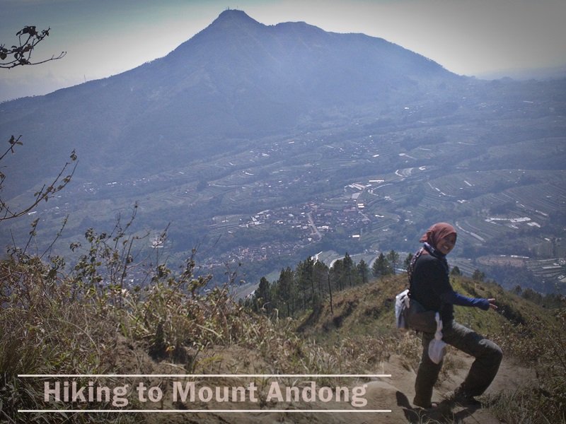
Well, don’t be confused. Today, I’ll share you one of my hiking journal to a mountain, named Mount Andong that is located in Magelang, Central Java, Indonesia. Mount Andong never have errupted activity. Based on the city border crossing points, it’s located between three city in Central Java, that is, Salatiga, Semarang, and Magelang. Its peak is only 1,726 meters (5662,73 ft) above sea level.
Elevation: Gain 5662,73 ft
Time: 2 – 3 hours
Difficulty: Medium, suitable for warming up
Season: Fall
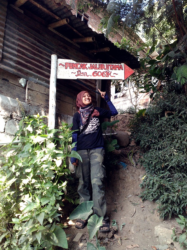
To reach the starting point or Mount Andong hiking basecamp, you only need to find the Girirejo village or Gogik village or Sawit village. Both villages can be reach from three different directions:
- From the South (Magelang, Yogyakarta, Purworejo, etc).
- From the North (Semarang, Ungaran, Boyolali, Solo, etc).
- From the West (Temanggung, Wonosobo, Banjarnegara, etc).
When you start from one of the three areas above, you need to find the Ngablak market. From there, you could take a public transportation–we called it “angkot”–to the village. If you mention Mount Andong, the angkot driver will take you there. Note: You better rent the angkot with your friends so you could share the cost together.
 After we reach the village, we will be welcomed by the villagers and they will lead you to the Mount Andong basecamp. There, you can rest and prepare your needs before hiking. The basecamp is one of the villagers house. The owner will provide you some hot tea ingredients and you could make your own hot tea based on your own taste. Sounds good, right? Yeah, the villagers hospitality will help you a lot during your preparation. So, just make sure all of your stuff is not left behind.
Start Hiking
After you packed up all of your stuff, you could ask for leaving to the leader in the village. Then, he will give you direction to the starting points. From the house to the starting point, you will walk for approximately 15 minutes, with the local people warmth that will cheer your journey.
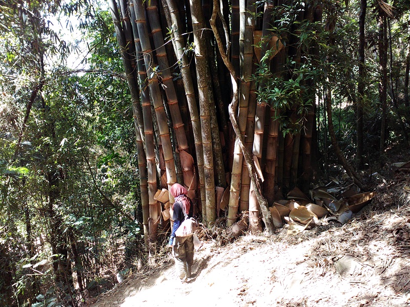
From starting point, you will walk on a light road with some pebbles and will find a bamboo garden, with an amazing bamboo diameters size! Most of the bamboos height is 20 meters and the diameters is 15 – 20 centimeters. I think it takes many years to grow and come to think of it, suddenly i think of Panda. How come there’s no Panda here? Doesn’t it great if we could hike and find a Panda. Haha!
There’s also some cloves and bushes that abandoned by colonial government a long time ago. And all this crops are fencing our starting track to the Mount Andong.
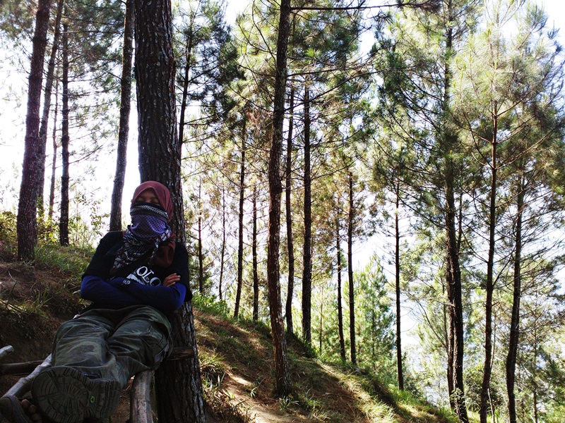
When you’ve passed the bamboo garden, the track will become more sloppy. It requires you to balance your respiratory system. You will pass the pine forests along your hike, but there’s no cool breeze at all. If you start hiking from 9 AM and choose the summer season, you will only find a scorching sun that lead your whole journey. It takes 2 to 3 hours to reach the Mount Andong’s peak and you can imagine how hot it is on the top.
But the good thing is you can find some peace. Hearing all those summer’s insect that produce a choir, featuring the sound of the pine leaves. It’s the sound of the universe. And sometimes, you still could hear the villagers cheering from below. You also could find some handmade benches that built by the villagers. You could rest there, and if you’re lucky enough, you could get some sleep.
Close to the top, the track will become harder. Sometimes you need to climb and hold on to some stepping stones, so you won’t fall. The pine forests has been passed and close to Mount Andong’s peak, the track will be so dusty. Mount Andong is an arid type of mountain, unlike some West Java’s mountain that was a tropical forest mountains. But, the views that provided by Mount Andong was really nice! You could see Salatiga, Magelang, Ambarawa from above. And far ahead, there’s Mount Sumbing and Sindoro that stand up straight just like an earth’s stake.
Suddenly, I remember one of ayah in Qur’an, mentioning, “Have we not made the earth as a wide expanse, and the mountains as pegs?” (Qur’an Suraah 78, 6-7)
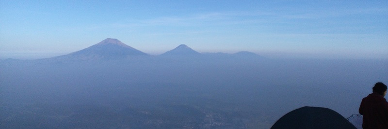 |
| Mount Sindoro and Sumbing |
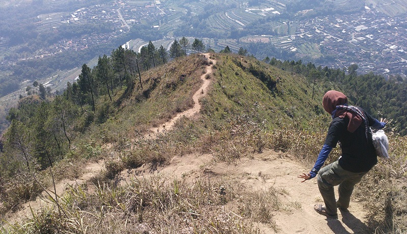 |
| our track |
After two hours, finally we reach the last hill. From here, we could see Mount Andong’s peak. The other hikers already there as we could see some tents that installed on the hill side.
We could see the two hills before Mount Andong’s peak that’s very famous, called camel’s hump or cattle’s hump. Well, whatever. I forgot this one. But it doesn’t matter whether you called it camel’s hump or cattle’s hump. It’s just gorgeous! After I saw the views by myself, I began to think that the city where i’m standing right now, is surrounded by some mountains. When we passed the last dusty track we could see Mount Sumbing and Mount Sindoro, then from the peak we could see Mount Merapi and Merbabu. So, Mount Andong is included in the sierra that surrounding Salatiga and Magelang city.
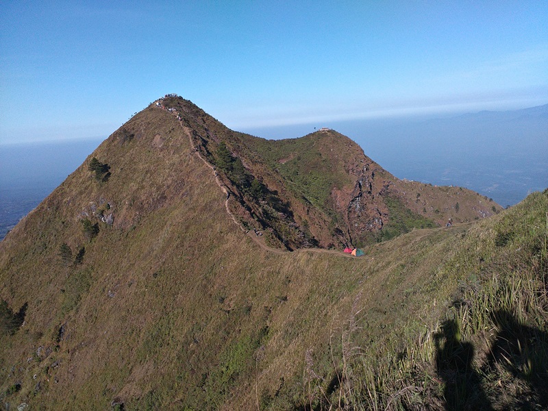 |
| Camel or Cattle? |
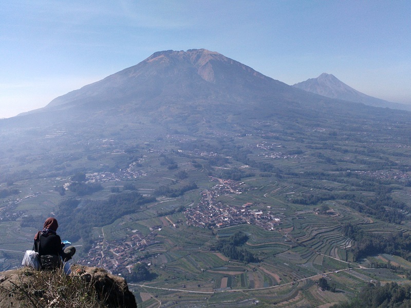 |
| Mount Merbabu and Merapi |
From the top, we could see that terracing views. Most of the villagers are working as a farmers. This terracing system is used by the villagers to plant some crops, such as cabbage, carrot, beans, eggplant, chili, etc.
That’s it. With only approximately two hours, you’ve got a bunch of photos, good views, a little fresh air and a little training before you hike another mountains in Indonesia with a higher difficulty level. And if you plan to hike this mountain past 3 PM, it’s not a bad idea. You will reach the last hills when sunset, and the views was really nice. The sky was red and the sun was really friendly. It’s the same when you decided to camp at this mountain. When you decided to camp, then you will be provided with a nice sunrise views. I also have been camping here and really enjoyed the sunrise moment.
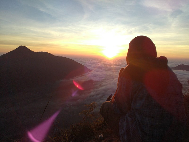 |
| sunrise moment back then… |
Now, let’s get down, head back to the basecamp and enjoying all the free treats from villagers. For myself, I head to the nearest noodles store that I could find. The cook sometimes add some extra meatballs and chili! Hmm, it’s yummy. And if you’re lucky, maybe you could find the local snacks in the village. It’s cheap and really tasty.
So, have you decided to hike this mountain? I guarantee, you will not be disappointed!
Happy hiking and don’t forget to share your experience at the comment box below!
Bonus!
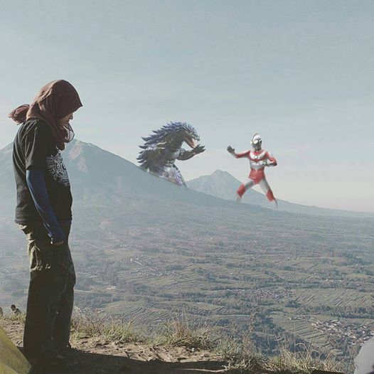 |
| if you’re so lucky, you could watch Ultraman vs Godzilla. here. well~ hmm. :)) |


Leave a comment